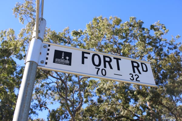
While Oxley may have changed a lot over the years, it still has many original street names.
But as the streetscapes themselves have evolved in the last few decades, locals may have forgotten the historical significance behind some of these local streets.
As part of the Oxley-Chelmer History Group, Marion Mackenzie knows all about the suburb’s history. We sat down with Marion and she shared the origins of some of Oxley’s well known streets.
Price and Enright Streets
Many young men in what is now 4075 were sent away to war. At the conclusion of the First World War, the Sherwood Shire Council, named two streets after two of the young men who were killed in Europe.
“Private Richard Price was the son of James and Adelaide Price. After leaving Oxley State School, Richard worked for the railways and enlisted and trained in a tunnelling company,” Marion says.
“Sapper Price, aged 21, was killed in action when tunnelling under Hill 70 near Loos in France in July 1917.”
Meanwhile, Private Michael Enright was the son of a widow, Sarah Enright. He also attended Oxley State School.
“He enlisted in August 1915 aged 18, but sadly he was killed in July 1916 at Pozieres in France,” Marion says.
“The short lives of these two young men are remembered in the streets of their former neighbourhood and their names are on both the Oxley and Graceville memorials.”
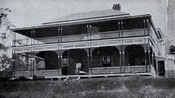 "Cliveden". Image: Oxley-Chelmer History Group
Cliveden Avenue and Blackheath Road
“William Davidson arrived in the colony in 1861 with his wife Mary, where he became Chief Surveyor in the Queensland Government,” says Marion.
“In 1889 Davidson built a grand house called Cliveden, on 7 hectares on what is now the corner of Cliveden Avenue and Blackheath Road,” she says.
It is after this house that Cliveden Avenue was named.
Marion says that the house was reputed to have a large ballroom and many bedrooms to accommodate a family of ten children.
The house was then bought by new owners and in 1923 was donated to the Presbyterian Church.
“It opened the following year as Blackheath Home, caring for boys in state care or whose parents could not care for them,” says Marion.
The Home closed in 1963 and the house was demolished soon afterwards.
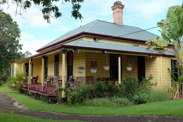 The Fort at Fort Road in 2018. Image: Oxley-Chelmer History Group
Seventeen Mile Rocks Road and Fort Road
Did you know that Seventeen Mile Rocks and Seventeen Mile Rocks Road were named after a rocky outcrop in the Brisbane River, seventeen nautical miles from the centre of Brisbane?
“It was first noted by John Oxley in 1823 as being a possible hazard to shipping because of the shallow water there at low tide...and in 1965 was blasted away in a dramatic fashion,” Marion says.
Meanwhile, Fort Road was named after the house known as The Fort, built by Henry Coxen in 1882.
“He said the site overlooking the River in two directions from a cliff top reminded him of a place in India known by that name,” Marion says.
Henry Coxen sold the property to the Corkran family, who later sold it to the Catholic Passionist Community who created what is still a retreat and a place of worship today.
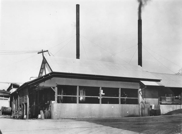 Factory Road. Image: Oxley-Chelmer History Group
Blunder Road and Factory Road
“There are several stories about the area known as The Blunder,” Marion says, adding that “Noah Wood, an early settler, related a tale of some bullock team drivers who gathered at a resting stop on Oxley Creek in the present Bowhill Road area.”
“One intoxicated driver led his team the wrong way and after a resulting accident, the place was remembered as The Blunder.”
Factory Road was named so because of the Foggitt Jones Meatworks, known to many as ‘The Factory’ from 1904.
“The factory largely processed ham and bacon and passed through a few owners before closing in 1992.”
--
Information supplied by the Oxley-Chelmer History Group. To learn more, please contact them at ochginc@gmail.com or phone Marion Mackenzie at 3379 1967.
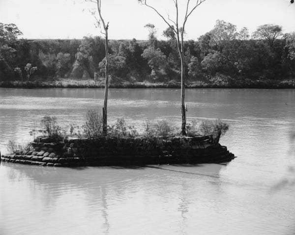 The Seventeen Mile Rocks. Image: Oxley-Chelmer History Group

